


Weather is the single biggest variable that makes Microsoft Flight Simulator feel like the real world. Clouds, wind shear, sudden thunderstorms, and subtle surface winds turn a textbook approach into a real challenge — and behind that illusion in MSFS sits a partnership: Asobo/Microsoft use Meteoblue’s forecast and analysis systems to populate the sim with plausible, earth-scale weather. In this article I’ll explain, in plain language, how Meteoblue’s global modelling becomes the 3D weather you fly through in MSFS, how local (airport) conditions are handled and blended, why METARs alone aren’t sufficient for a convincing global weather field, and finally a compact, hands-on guide to reading METARs so you can use real reports alongside the sim.
Meteoblue is a Swiss meteorological-service company that builds forecasts using many numerical weather models, data assimilation and proprietary post-processing. For MSFS they supply the forecast/model output and observational inputs that become the simulator’s “live weather” layer. The partnership began during development of the MSFS 2020 edition and has continued into the MSFS 2024 era: Meteoblue supplies hourly automated weather updates (forecast grids and derived variables like wind, temperature, humidity, cloud fraction, precipitation, etc.) which Asobo ingests to create the simulator’s worldwide weather scene across latitude/longitude grids at multiple vertical levels.

From global forecast grids to a flying simulator
Here’s a simplified sequence of how Meteoblue weather to MSFS weather happens:
- Data generation at Meteoblue. Meteoblue runs and combines many numerical weather models and observational inputs to produce forecast grids (multiple horizontal resolutions and vertical levels, plus derived products). These data include winds (speed + direction) at different altitudes, temperatures, humidity, cloud fraction and precipitation rates.
- Packaging & delivery. The forecast fields are packaged into compact, queryable datasets, and delivered to Microsoft’s web services at regular intervals. That lets the sim request the latest grid for a region or time.
- Ingest and interpolation by the sim. MSFS receives the gridded forecast and interpolates it spatially and vertically to create a continuous, 3D representation of the atmosphere over the globe (or over the area the user is flying). The sim samples that field around the aircraft for rendering clouds, precipitation, wind vectors, temperature, and so on.
- Local refinement / blending. Near airports and along the surface, MSFS uses additional data sources — including METARs (observed station reports) — to nudge or blend surface parameters (especially wind/gusts and pressure) so the airport environment feels like the real world. As the devs have explained, METAR observations are blended in where available, otherwise the sim relies on the model fields from Meteoblue.
- Rendering & physics. The sim converts the interpolated fields into visible clouds (3D volumetric clouds), precipitation, turbulence and wake effects. In MSFS there have been further refinements to turbulence and wake modelling (CFD-like local effects for updrafts, mountain wave and wake), which operate on the sampled wind and stability fields the sim has derived from the weather input.
Two important takeaways: The sim doesn’t just “copy and paste” a METAR into the sky — it uses a physically-consistent model field to build the 3D weather, and METARs are observational anchors at surface locations, not a global source of 3D structure.

Global vs local weather: why a gridded model is necessary
Why global gridded data?
METARs are point observations — surface reports from a specific site, e.g. airports. They tell you what the weather was at a point at a time (visibility, cloud ceiling, wind at the station, pressure, temperature). But clouds are volumetric and weather systems have structure across kilometers and vertically: a line of convective cells, a cold front, or wind shear aloft. To recreate those structures you need a model grid that describes the atmosphere at many locations and altitudes simultaneously. Meteoblue produces such gridded forecasts (often combining dozens of models and post-processing), which structurally represent fronts, layers, precip fields and wind shear — exactly what a 3D sim needs.
Why METARs still matter
METARs remain critical because they are the ground truth at airports — they capture real, measured surface winds, gusts and present weather that a forecast model may not perfectly match, especially close to the surface where local effects (runway, buildings, terrain) matter. Asobo’s team has explicitly said they blend METAR gust and wind data in close to airports and fall back to model fields where METARs are absent or incomplete. That blend helps approaches and departures feel correct for the airport in question.

How MSFS uses Meteoblue fields to simulate clouds, precipitation and turbulence
Once the model fields are available inside MSFS, they are used in several distinct ways:
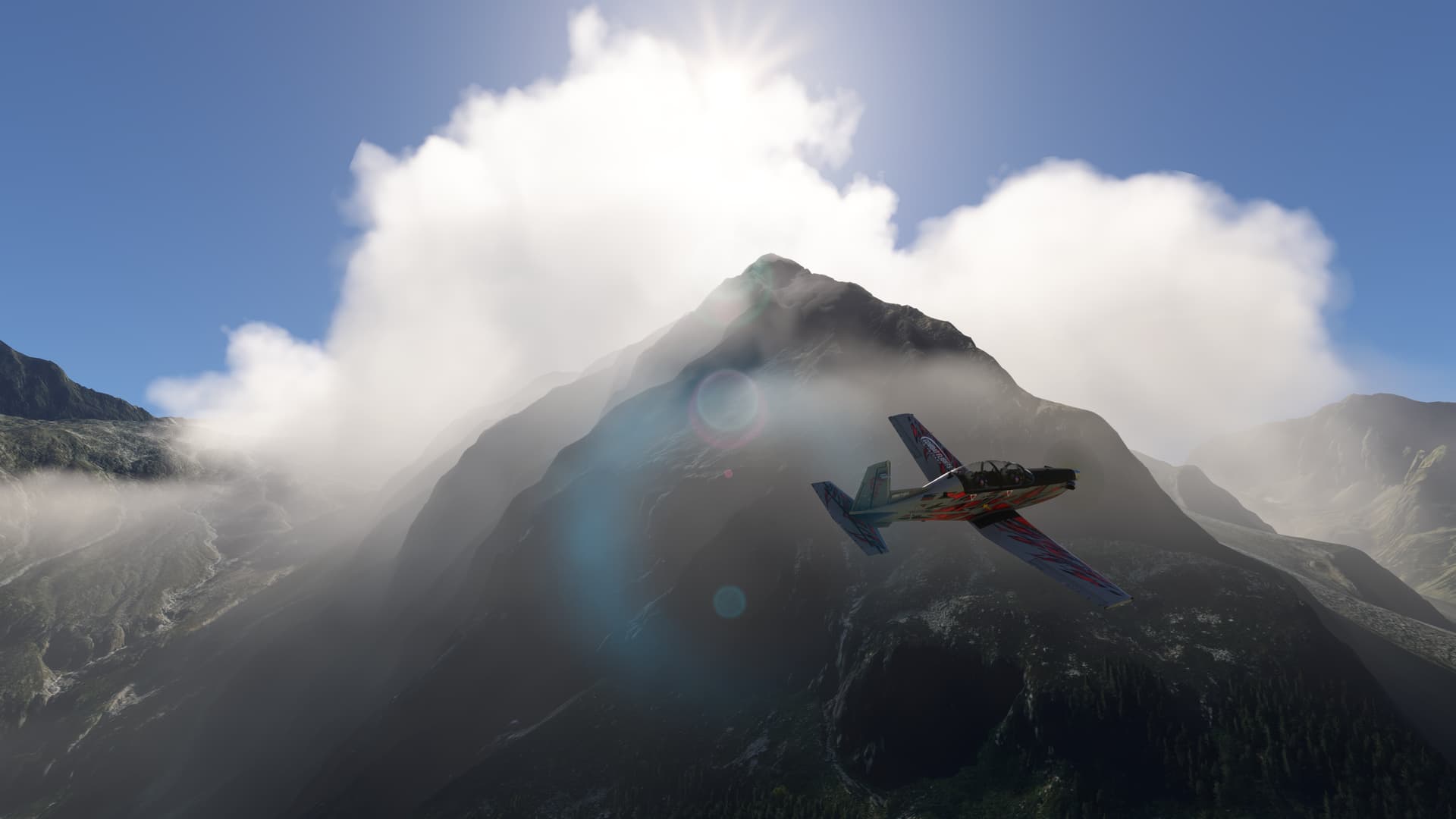
- Cloud rendering & vertical structure. Cloud fraction and liquid/ice content at different altitudes are sampled to build volumetric clouds (cumulus, stratus, layered clouds, convective towers). The model’s vertical humidity and temperature structure helps decide cloud base/top and how extended/convective the clouds should be. This is what makes lines of convective cells (CBs) or stratocumulus decks appear plausible rather than random sprites.
- Precipitation intensity & type. Precipitation rate from the forecast grid determines whether the sim shows drizzle, steady rain, or heavy convective downpours; temperature profiles determine rain vs. snow. The engine maps integrated precipitation and microphysics variables into particle effects and splash rendering.
- Wind fields & turbulence. Horizontal and vertical wind components at multiple levels are used to render wind in the cockpit, affect flight dynamics, and produce low-level turbulence and shear. MSFS added more realistic turbulence and wake/CFD interactions, making gusts and mountain waves interact with aircraft more convincingly when the sampled fields indicate unstable or strong flows.
- Lightning & thunder. Convective indices and precipitation intensity feed the trigger logic for lightning visuals and thunder, including probability of cell electrification for a given grid cell.
All of these effects are deterministic outputs of the forecast fields combined with the sim’s rendering and physics subsystems — so quality depends directly on the model resolution, model ensemble skill, and how frequently the data are refreshed. Meteoblue’s forecast suite are designed to provide those building blocks.

Why “METAR weather” alone isn’t ideal for global rendering
It’s helpful to think of the differences like this:
- METAR (observation): high-fidelity point picture at the surface at the time of observation (winds, visibility, cloud base, temperature, pressure, present weather). Great for airport surface conditions. But METARs say almost nothing about the distribution of clouds and winds several kilometers away or aloft. They can be sparse over oceans and remote areas.
- Model/forecast grid (Meteoblue): continuous spatial 3D fields representing atmospheric state (winds aloft, humidity profiles, precip) over regions. Great for reconstructing extended features like storm systems, cloud decks, fronts and shear. But models have forecast errors and may need to be corrected against surface observations.
Because a global flight simulator requires both the 3D structure (to render believable weather at distance and aloft) and the point realism at airports (for takeoff/landing), the best approach (which MSFS uses) is to use the model for the 3D field and blend in METARs near airports where accurate surface readings matter. That’s the compromise between realism and physical plausibility.

So… does MSFS display “real METARs” in-sim?
MSFS exposes METARs in menus and can use them as a data source for airport information, but the simulated 3D weather scene is primarily model-derived. The dev team has stated that gusts and surface wind are injected either from Meteoblue live data or, when a METAR exists nearby and includes gusts, from the METAR — blending the two to produce a seamless near-airport experience. Some community tools generate or translate METARs to weather presets, and there are external utilities that synthesize METARs from model data, but those are third-party solutions.
How to get the best “real-world” feel
- If you want the sim to match a particular airport’s exact reported surface conditions, check the METAR from a reputable source (or use an external METAR tool) and use a weather preset or mod that applies that METAR to the sim. Third-party utilities (and some community mods) can convert METARs into MSFS weather presets.
- For long cross-country flights or VFR flying that depends on cloud structure miles away, trust the model-driven “live weather” — it’s the only way to get coherent 3D cloud systems aligned with synoptic features.
- Remember model latency and resolution: sometimes convective cells move faster/further than the forecast captured in the grid — be ready for differences between what ATIS/METAR says and the cloudscape you see out the window. Community comparisons show live weather is good but imperfect — small shifts are to be expected.

Common FAQ and myth-busting
- “Why doesn’t MSFS just use METARs for everything?”
Because METARs are point observations — they don’t tell the sim how clouds or winds behave miles away or aloft. A global sim needs volumetric fields (models) to reproduce distant storms, cloud decks and vertical structures. So the sim uses model grids for the 3D atmosphere, and METARs where point truth matters (surface). - “Why do METARs sometimes disagree with the sim?”
Forecast grids can be a bit out of sync (timing, position) compared to local observations, and models have limited resolution; convective cells especially are hard to predict at exact locations. MSFS blends METARs for surface winds, but the broader cloudscape may still reflect the model state rather than a single station’s snapshot. Community tests show live weather is good on average but not perfect. - “Can MSFS show me the METAR the sim is using?”
MSFS shows METARs in some menus and third-party tools can expose METARs and convert them to presets — but internally the sim’s live weather is model-based; the displayed METAR might be a raw report separate from that 3D field.
Parting note
Weather in Microsoft Flight Simulator is a marriage between the global, three-dimensional realism of meteorological models and the punctual truth of airport observations. Meteoblue supplies the forecast scaffolding; MSFS renders it into clouds, rain and turbulence; METARs anchor you at the surface. Understanding both pieces — how models work and how to decode METARs — will help you get more out of the sim, whether you’re flying a short VFR hop or a long, stormy airliner leg.
Quick guide: how to read a METAR
METARs are compact, heavily-coded text observations used worldwide. Below is a short, practical primer with an example and step-by-step decode.
METAR ENHD AUTO 170520Z 29018G30KT 260V330 9999 VCSH SCT012TCU BKN026 13/11 Q1005 RERA=
Step-by-step Decode
- METAR – Routine aviation weather observation.
- ENHD – ICAO airport code: Haugesund Airport, Norway.
- AUTO – This report is automatically generated (no human augmentation).
- Automated stations may occasionally omit phenomena that need human observation (like some types of lightning or cloud types), but they still report the basics (wind, visibility, pressure, etc.).
- 170520Z – Time stamp:
- 17 → Day of month (17th).
- 0520Z → 05:20 UTC (Zulu).
- 29018G30KT – Wind data:
- 290 → Wind from 290° (just west of northwest).
- 18KT → Sustained wind speed: 18 knots.
- G30KT → Gusting to 30 knots — quite gusty!
- 260V330 – Variable wind direction range:
- Wind direction is fluctuating between 260° and 330°.
- Important for pilots: large swings in crosswind component on final approach.
- 9999 – Visibility:
- Visibility in meters (Europe/ICAO format).
9999= 10 km or more (commonly shown as maximum). In US/FAA METARs you may see miles, e.g.,10SM.
- Visibility in meters (Europe/ICAO format).
- VCSH – Weather phenomena:
- VC = “In the vicinity” (8–16 km from the station).
- SH = Showers.
- So: Showers are occurring near the airfield but not overhead.
- SCT012TCU – Cloud layers:
- SCT012 = Scattered clouds at 1,200 ft above ground level (AGL).
- TCU = Towering cumulus — indicates strong vertical development (possible turbulence and rain showers).
- BKN026 – Second cloud layer:
- BKN026 = Broken clouds at 2,600 ft above ground level (AGL), this is the ceiling, since broken/overcast defines ceiling conditions.
- 13/11 – Temperature/Dewpoint:
- 13°C temperature, 11°C dew point.
- Small spread (2°C), air is fairly moist — good environment for showers and cloud growth.
- Negative values have an
M: e.g.,M02= −2°C.
- Q1005 – Altimeter setting:
- Q = altimeter pressure (QNH) in hectopascals;
Q1005= 1005 hPa. - In the US you’ll see, e.g.,
A2992meaning 29.92 inHg. - 1005 hPa is the sea-level pressure to set on your altimeter.
- RERA – Recent weather:
- RE = Recent.
- RA = Rain.
- Means there was recent rain, but it is not falling at the time of observation.
- = – End of report.

Plain-English Summary
At Haugesund Airport (ENHD) on the 17th at 05:20 UTC, an automated station reports:
- Winds: From 290° at 18 knots, gusting 30 knots, with direction fluctuating between 260° and 330° — very gusty and variable.
- Visibility: 10 km or more (good).
- Weather: Showers nearby but not overhead; it rained recently.
- Clouds: Scattered towering cumulus at 1,200 ft AGL (potentially turbulent) and a broken ceiling at 2,600 ft.
- Temp/Dew: 13°C / 11°C (humid).
- Pressure: 1005 hPa QNH.
In short: gusty, variable winds, showers nearby, convective clouds developing — expect turbulence and rapidly changing weather near the field.